
Vicki Salazar records an invasive plant occurrence with the CalFlora Observer Pro iPhone app. ©Nancy Hamlett.

Vicki Salazar checks out an unknown grass. ©Nancy Hamlett.
The Friends are currently mapping invasive plants in the Claremont Hills Wilderness Park, and Saturday morning we mapped invasives along the first section of the Cobal Canyon Trail. This is what the resulting map on CalFlora looks like:
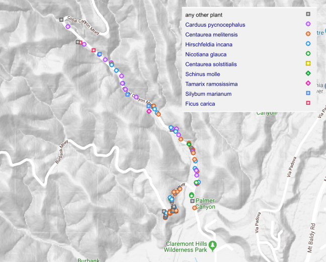
If you go the actual CalFlora page, you can click on a dot and see details of each observation, including photos and number of plants. There are a lot of invasive plants along the Cobal Canyon trail, and in fact the Master Plan noted that Cobal Canyon had the highest number of different invasive species.
If you would like to help with the mapping effort, please contact us at info@friendsofthewildernesspark.org, and we’ll contact you to sign you up for instruction and mapping.
